
The Kettle Creek Watershed
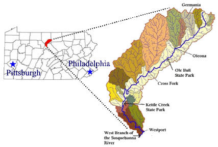
The Kettle Creek watershed is located in the Deep Valley Section of the Appalachian Plateau physiographic province in northcentral Pennsylvania. At approximately 244 square miles, over 90% of the watershed lies within state forest and state park lands. The main stem of Kettle Creek traverses nearly 43 miles beginning in southwestern Tioga County, flowing through Potter County, and then emptying into the West Branch of the Susquehanna River in northwestern Clinton County.
There are over 350 miles of coldwater tributaries, many of which are designated by the PA Fish and Boat Commission as Class A Wild Trout streams. However, even though the majority of the watershed is considered “Exceptional Value” by the PA Department of Environmental Protection in terms of water quality, the Kettle Creek watershed suffers from acid mine drainage (AMD) in its lower watershed. The AMD is a result of historic coal mining practices that took place in the lower watershed beginning in the late 1800’s. Now hundreds of acres of unreclaimed surface mines and abandoned deep mines exist and discharge AMD that renders the receiving streams lifeless. The upper and middle portions of the Kettle Creek watershed experience problems with excessive sediment loads and high temperatures that are partially due to historic logging and stream channelization, as well as several major flood events.